
Close Menu
CEOColumnCEOColumn
    What's Hot

    After the Storm: What a Helicopter Damage Survey Can Document for Florida Property Managers and Insurers

    November 9, 2026

    6 Day Trading Platform Picks UK Traders Should Vet in 2027

    November 9, 2026

    A Practical Photo Editing Workflow for Small Business Case Studies

    November 9, 2026
    Facebook X (Twitter) Instagram
    Facebook X (Twitter) Instagram
    CEOColumnCEOColumn
    Subscribe
    • Home
    • News
    • BLOGS
      1. Health
      2. Lifestyle
      3. Travel
      4. Tips & guide
      5. View All

      How to Turn Medical Records Into Clear, Useful Summaries

      November 1, 2026

      Critical Illness Insurance Explained: Key Features, Inclusions & Claims

      October 26, 2026

      Doctors’ Indemnity Insurance: Why Every Healthcare Practitioner Needs It

      October 26, 2026

      How to Make Personal Training Fit Your Schedule, Goals, and Budget

      October 26, 2026

      Signs Your Florida Home Has a Humidity Problem and How Experts Can Fix It

      October 27, 2026

      Motion Sofa: Flexible Seating for Modern Living Spaces

      October 24, 2026

      How to Plan a Proposal Around Your Partner’s Style

      October 8, 2026

      Best Shampoo for Dandruff: Top Picks for a Healthy Scalp

      October 5, 2026

      How to Efficiently Manage Dual SIMs on One Phone for Frequent Business Travel

      October 22, 2026

      How to Find the Best Villas in Goa for Birthday Celebrations and Parties

      October 16, 2026

      Red Sea Days and Desert Nights in Hurghada

      October 7, 2026

      Luxury Crewed Yacht Charters in Greece: A Complete Guide to Private Yacht Holidays

      October 2, 2026

      Open Enrollment for the Self-Employed: How to Pick a Plan Without an Employer

      November 4, 2026

      How Pool Size and Depth Affect Water Chemistry Stability

      October 24, 2026

      Language Barriers While Traveling: What Actually Helps in Real-World Conversations?

      September 29, 2026

      How therapeutic techniques can vary from one practitioner to another

      September 29, 2026

      After the Storm: What a Helicopter Damage Survey Can Document for Florida Property Managers and Insurers

      November 9, 2026

      Practical Strategies for Managing Chronic Pain

      November 5, 2026

      Do Americans Trust the IRS? Optima Tax Relief Shares New Taxpayer Findings

      November 5, 2026

      Planning a Hot Tub Purchase Before the Holidays: Timelines, Delivery, and Install Windows

      November 5, 2026
    • BUSINESS
      • OFFLINE BUSINESS
      • ONLINE BUSINESS
    • PROFILES
      • ENTREPRENEUR
      • HIGHEST PAID
      • RICHEST
      • WOMEN ENTREPRENEURS
    • Lifestyle
    CEOColumnCEOColumn
    Home»BLOGS»After the Storm: What a Helicopter Damage Survey Can Document for Florida Property Managers and Insurers

    After the Storm: What a Helicopter Damage Survey Can Document for Florida Property Managers and Insurers

    OliviaBy OliviaNovember 9, 2026No Comments6 Mins Read
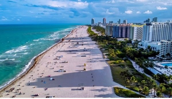
    above (Pexels, free licence). Alt text: Aerial view of Miami Beach hotels and coastline.

    The week after a hurricane moves quickly. Water recedes, debris gets pushed to the curb, and crews start tarping roofs and boarding windows. Each of those steps changes the picture before every owner, manager, adjuster and contractor who needs a record has seen it. For anyone responsible for more than one building, the hard part is often not the repair. It is knowing what each site looked like before anything was touched. An aerial survey is one way to capture that view, alongside ground photos, drones, public imagery and in-person inspections.

    Table of Contents

    Toggle
    • Why the First Days After a Storm Are a Documentation Problem
    • What an Aerial View Can Document, and What It Can’t
    • Helicopter, Drone or Satellite: Choosing the View
    • The Baseline Flight: Why “Before” Makes “After” Useful
    • Lining Up the Flight Before You Need It
    • Safety and Limits
    • Frequently Asked Questions

    Why the First Days After a Storm Are a Documentation Problem

    After a major storm, conditions do not hold still. Floodwater spreads and then drains. Debris shifts with wind and cleanup. Temporary repairs cover damage that may need to be assessed later. A single set of photos taken on one day captures only one moment in that sequence.

    Repeated observation helps. An initial flight might document flooding across a site and damaged access roads, while a later flight could show which areas have dried, which entrances remain blocked, and where debris is still sitting against buildings. Side by side, those views show owners and claims teams how conditions changed, and in what order.

    This matters most for portfolios. A manager with a dozen properties spread across a county cannot be at each one on the first morning. Detailed engineering inspections and ground investigations remain necessary, but aerial assessment can help determine where those resources should be directed first.

    What an Aerial View Can Document, and What It Can’t

    From above, a survey can record a lot of what matters in the first pass:

    • Visible roof and building envelope damage
    • The extent of standing water across lots, parking areas and nearby streets
    • Debris fields, including fallen trees and material carried onto a site
    • Blocked or washed-out access routes
    • Changes to seawalls, docks, dunes and shoreline
    • How one property sits among its neighbors, which helps show whether damage is local or widespread

    A single flight can also cover several scattered sites.

    The limits are just as important. An aerial image cannot see inside a building. It cannot measure moisture in walls or under flooring, confirm whether a structure is sound, or establish the cause of a loss. A roof that looks intact from above can still be leaking.

    So treat the imagery as a starting point for the adjuster and the engineer, not a stand-in for either. It works best as a map of where to look first and a record of what was visible on a given day.

    Helicopter, Drone or Satellite: Choosing the View

    Each option answers a different question.

    A helicopter suits range. It can move between properties spread across a metro area or along a stretch of coast in a single mission and record them under similar conditions. Survey helicopters can also be fitted with sensor payloads, such as LiDAR systems for terrain modeling or high-resolution imaging systems.

    A drone suits a close look at one site. It can get near a roofline or damaged wall. After a disaster, though, temporary flight restrictions can apply over affected areas, and any drone flight has to fit within FAA rules for that airspace.

    Satellite and public aerial imagery suits the big picture. After major storms, NOAA’s National Geodetic Survey publishes Emergency Response Imagery, collected “to support NOAA homeland security and emergency response requirements.” It is free and useful for seeing the overall pattern of damage, but you do not control when it is captured, which areas are covered or how much detail it shows.

    The Baseline Flight: Why “Before” Makes “After” Useful

    Post-storm imagery is far more useful when there is something to compare it with. A roofline, a seawall or a drainage swale photographed in calm conditions gives everyone a reference point.

    Survey work handles this through repeat flights. When an operator flies the same lines on a schedule, each data set can be compared cleanly with the last, and if LiDAR is added, terrain models can be compared survey to survey. The same logic applies to property. A baseline captured in an ordinary month, followed by a flight over the same lines after a storm, turns two sets of pictures into a before-and-after record.

    The off-season is the natural time to think about this. Owners can decide which sites would benefit from a baseline, what level of detail they want and how the files should be stored, then revisit the plan as next season approaches.

    Lining Up the Flight Before You Need It

    A few decisions are worth making well ahead of time:

    • A property list with priorities, so the sites that matter most are flown first
    • Contact procedures, including who can request a flight and who receives the files
    • Agreement on the imagery and format you want, such as oblique photos, overhead mapping or LiDAR, and how files will be delivered
    • Any open ground near your sites where an aircraft could set down, since that shapes how a mission is routed

    Airspace is part of the plan too. Around busy airports, survey flights are coordinated with air traffic control, so flight lines are cleared before the aircraft goes up.

    In South Florida, Wave Helicopters provides helicopter aerial survey services in Miami, working with engineering firms, municipalities and developers, and notes that it also flies rapid assessments after hurricanes and major floods. Whether a given operator takes on private property work after a storm, and what it can deliver, is a question to ask directly, well before the next storm.

    Safety and Limits

    Weather and safety set the schedule for any survey flight. Gusts, low cloud and loose debris can linger for days after a storm, and a crew weighs all of it against the aircraft, the terrain, the airspace and what the flight needs to capture. If conditions do not allow a safe flight, the mission may need to be delayed, modified or supported another way. Imagery that arrives a little later than hoped is still useful. A flight that should not have gone up is not.

    Frequently Asked Questions

    Can aerial imagery replace an adjuster’s or engineer’s inspection?

    No. Aerial imagery records what is visible from above. Interiors, moisture, structural condition and cause of loss still need to be assessed on the ground.

    How soon after a hurricane can a survey flight go up?

    When weather, airspace and safety allow. Conditions and any flight restrictions vary from storm to storm.

    What does LiDAR add to photos after a storm?

    Photos show what a site looks like. LiDAR measures surface shape and elevation to build a terrain model. Compared with an earlier model of the same area, it can show where ground, dunes or shoreline have changed.

    What should a property portfolio prepare before hurricane season?

    A prioritized property list, clear contacts, an agreed imagery format and, where it makes sense, a baseline flight recorded in calm conditions.

    Share. Facebook Twitter Pinterest LinkedIn Tumblr Telegram Email
    Previous Article6 Day Trading Platform Picks UK Traders Should Vet in 2027
    Olivia

    Olivia is a contributing writer at CEOColumn.com, where she explores leadership strategies, business innovation, and entrepreneurial insights shaping today’s corporate world. With a background in business journalism and a passion for executive storytelling, Olivia delivers sharp, thought-provoking content that inspires CEOs, founders, and aspiring leaders alike. When she’s not writing, Olivia enjoys analyzing emerging business trends and mentoring young professionals in the startup ecosystem.

    Related Posts

    Practical Strategies for Managing Chronic Pain

    November 5, 2026

    Do Americans Trust the IRS? Optima Tax Relief Shares New Taxpayer Findings

    November 5, 2026

    Planning a Hot Tub Purchase Before the Holidays: Timelines, Delivery, and Install Windows

    November 5, 2026
    Add A Comment
    Leave A Reply Cancel Reply

    You must be logged in to post a comment.

    Latest Posts

    After the Storm: What a Helicopter Damage Survey Can Document for Florida Property Managers and Insurers

    November 9, 2026

    6 Day Trading Platform Picks UK Traders Should Vet in 2027

    November 9, 2026

    A Practical Photo Editing Workflow for Small Business Case Studies

    November 9, 2026

    R.E. Cost Seg Review: A Specialist’s Take on Accelerated Depreciation

    November 7, 2026

    Why Field Service Management Software Has Become Essential for Growing Trade Businesses

    November 7, 2026

    Why Hiring a Criminal Defense Lawyer Early Can Change Your Case

    November 6, 2026

    How Nonprofit Attorneys Help Organizations Choose the Right Structure

    November 6, 2026

    How Workplace Accident Claims Protect Injured Delivery Drivers

    November 6, 2026

    Term Insurance or Life Insurance: Which Plan Fits Your Family’s Needs?

    November 6, 2026

    Private Label and the Only Seller on the Listing: PricingMag on Whether Repricing Matters

    November 6, 2026
    Recent Posts
    • After the Storm: What a Helicopter Damage Survey Can Document for Florida Property Managers and Insurers November 9, 2026
    • 6 Day Trading Platform Picks UK Traders Should Vet in 2027 November 9, 2026
    • A Practical Photo Editing Workflow for Small Business Case Studies November 9, 2026
    • R.E. Cost Seg Review: A Specialist’s Take on Accelerated Depreciation November 7, 2026
    • Why Field Service Management Software Has Become Essential for Growing Trade Businesses November 7, 2026

    Your source for the serious news. CEO Column - We Talk Money, Business & Entrepreneurship. Visit our main page for more demos.

    We're social. Connect with us:
    |
    Email: Support@gposting.com

    Facebook X (Twitter) Instagram Pinterest LinkedIn WhatsApp
    Top Insights

    After the Storm: What a Helicopter Damage Survey Can Document for Florida Property Managers and Insurers

    November 9, 2026

    6 Day Trading Platform Picks UK Traders Should Vet in 2027

    November 9, 2026

    A Practical Photo Editing Workflow for Small Business Case Studies

    November 9, 2026
    © Copyright 2025, All Rights Reserved
    • Home
    • Pricacy Policy
    • Contact Us

    Type above and press Enter to search. Press Esc to cancel.