

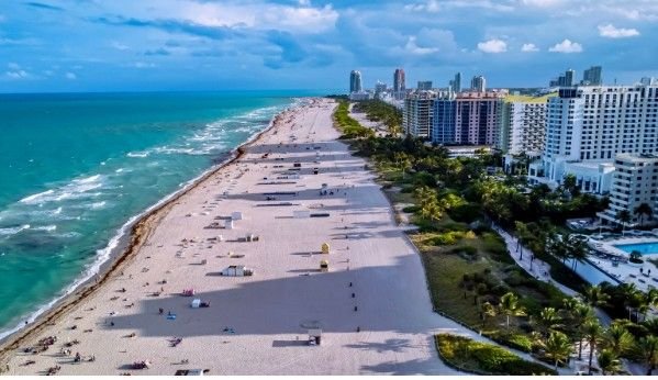
The week after a hurricane moves quickly. Water recedes, debris gets pushed to the curb, and crews start tarping roofs and boarding windows. Each of those steps changes the picture before every owner, manager, adjuster and contractor who needs a record has seen it. For anyone responsible for more than one building, the hard part is often not the repair. It is knowing what each site looked like before anything was touched. An aerial survey is one way to capture that view, alongside ground photos, drones, public imagery and in-person inspections.
Why the First Days After a Storm Are a Documentation Problem
After a major storm, conditions do not hold still. Floodwater spreads and then drains. Debris shifts with wind and cleanup. Temporary repairs cover damage that may need to be assessed later. A single set of photos taken on one day captures only one moment in that sequence.
Repeated observation helps. An initial flight might document flooding across a site and damaged access roads, while a later flight could show which areas have dried, which entrances remain blocked, and where debris is still sitting against buildings. Side by side, those views show owners and claims teams how conditions changed, and in what order.
This matters most for portfolios. A manager with a dozen properties spread across a county cannot be at each one on the first morning. Detailed engineering inspections and ground investigations remain necessary, but aerial assessment can help determine where those resources should be directed first.
What an Aerial View Can Document, and What It Can’t
From above, a survey can record a lot of what matters in the first pass:
- Visible roof and building envelope damage
- The extent of standing water across lots, parking areas and nearby streets
- Debris fields, including fallen trees and material carried onto a site
- Blocked or washed-out access routes
- Changes to seawalls, docks, dunes and shoreline
- How one property sits among its neighbors, which helps show whether damage is local or widespread
A single flight can also cover several scattered sites.
The limits are just as important. An aerial image cannot see inside a building. It cannot measure moisture in walls or under flooring, confirm whether a structure is sound, or establish the cause of a loss. A roof that looks intact from above can still be leaking.
So treat the imagery as a starting point for the adjuster and the engineer, not a stand-in for either. It works best as a map of where to look first and a record of what was visible on a given day.
Helicopter, Drone or Satellite: Choosing the View
Each option answers a different question.
A helicopter suits range. It can move between properties spread across a metro area or along a stretch of coast in a single mission and record them under similar conditions. Survey helicopters can also be fitted with sensor payloads, such as LiDAR systems for terrain modeling or high-resolution imaging systems.
A drone suits a close look at one site. It can get near a roofline or damaged wall. After a disaster, though, temporary flight restrictions can apply over affected areas, and any drone flight has to fit within FAA rules for that airspace.
Satellite and public aerial imagery suits the big picture. After major storms, NOAA’s National Geodetic Survey publishes Emergency Response Imagery, collected “to support NOAA homeland security and emergency response requirements.” It is free and useful for seeing the overall pattern of damage, but you do not control when it is captured, which areas are covered or how much detail it shows.
The Baseline Flight: Why “Before” Makes “After” Useful
Post-storm imagery is far more useful when there is something to compare it with. A roofline, a seawall or a drainage swale photographed in calm conditions gives everyone a reference point.
Survey work handles this through repeat flights. When an operator flies the same lines on a schedule, each data set can be compared cleanly with the last, and if LiDAR is added, terrain models can be compared survey to survey. The same logic applies to property. A baseline captured in an ordinary month, followed by a flight over the same lines after a storm, turns two sets of pictures into a before-and-after record.
The off-season is the natural time to think about this. Owners can decide which sites would benefit from a baseline, what level of detail they want and how the files should be stored, then revisit the plan as next season approaches.
Lining Up the Flight Before You Need It
A few decisions are worth making well ahead of time:
- A property list with priorities, so the sites that matter most are flown first
- Contact procedures, including who can request a flight and who receives the files
- Agreement on the imagery and format you want, such as oblique photos, overhead mapping or LiDAR, and how files will be delivered
- Any open ground near your sites where an aircraft could set down, since that shapes how a mission is routed
Airspace is part of the plan too. Around busy airports, survey flights are coordinated with air traffic control, so flight lines are cleared before the aircraft goes up.
In South Florida, Wave Helicopters provides helicopter aerial survey services in Miami, working with engineering firms, municipalities and developers, and notes that it also flies rapid assessments after hurricanes and major floods. Whether a given operator takes on private property work after a storm, and what it can deliver, is a question to ask directly, well before the next storm.
Safety and Limits
Weather and safety set the schedule for any survey flight. Gusts, low cloud and loose debris can linger for days after a storm, and a crew weighs all of it against the aircraft, the terrain, the airspace and what the flight needs to capture. If conditions do not allow a safe flight, the mission may need to be delayed, modified or supported another way. Imagery that arrives a little later than hoped is still useful. A flight that should not have gone up is not.
Frequently Asked Questions
Can aerial imagery replace an adjuster’s or engineer’s inspection?
No. Aerial imagery records what is visible from above. Interiors, moisture, structural condition and cause of loss still need to be assessed on the ground.
How soon after a hurricane can a survey flight go up?
When weather, airspace and safety allow. Conditions and any flight restrictions vary from storm to storm.
What does LiDAR add to photos after a storm?
Photos show what a site looks like. LiDAR measures surface shape and elevation to build a terrain model. Compared with an earlier model of the same area, it can show where ground, dunes or shoreline have changed.
What should a property portfolio prepare before hurricane season?
A prioritized property list, clear contacts, an agreed imagery format and, where it makes sense, a baseline flight recorded in calm conditions.
