


Quick Way To Use a Deed Plotter to Verify Land Descriptions
Creating accurate descriptions of land is crucial in real estate transactions. Because misunderstandings or missteps could result in costly litigation. Deed plotters give a more realistic approach to verifying boundaries and property descriptions. With a simple process, anyone can use this tool to feel confident about property details.
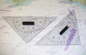
What Is a Deed Plotter?
A deed plotter is a digital solution that converts written real estate properties into maps. It reads bearings and distances from deeds. The output then is the graphical depiction of the property size and configuration. This visualization helps identify discrepancies or mistakes in the text.
1. Gathering Essential Documents
It is important to gather all property documents, including the deed, any legal descriptions, and surveying records, before using a deed plotter. This eliminates uncertainty so that the plotted boundaries match the land involved in the transaction. Taking the time to prepare properly minimizes the chances of any misinterpretation further down the line.
2. Entering the Legal Description
Each deed contains a path by which directions, angles, and distances are described. When you add these elements into the deed plotter, it makes it more detailed. Users must type each segment in the correct order. Mistakes such as numbers skipped or misread lead to an erroneous plot. Therefore, you can avoid errors this way because each entry is cross-checked against the document.
3. Reviewing the Visual Property Map
The deed plotter produces a graphical representation of the property after all data is entered. Then you can use this image to see the outline of the property as described in the deed. This visual makes it easy for users to identify if the shape looks accurate or if it has some sharp corners not related to the design mentioned. Deviations in the diagram, such as scales or gaps, indicate mistakes in the legal description or in data entry errors.
4. Comparing With Existing Surveys
Once the map is prepared, please compare it with any survey designs or tax maps you are able to locate. Such comparisons can bring out differences in documents. The confidence in the legal description increases if the shapes align. If any of those results don’t match up, that could require further investigation. Sometimes this shows whether a new survey is needed or whether the deed requires the correction.
5. Identifying Common Errors
The errors are more common in old deeds or handwritten records. Reading the wrong orientation, numbers out of order, or using imprecise terms jumbles the map message. There could be a property boundary that does not close up properly, or the plot looks irregular. Addressing these types of issues early on can prevent misunderstandings, so it’s advisable to be proactive. One tool that can catch these types of mistakes before the larger transaction occurs is the deed plotter.
6. Seeking Professional Guidance
A deed plotter can provide some good information, but in some cases, you will want to enlist the help of an expert. Professional surveyors can read complicated descriptions and settle disagreements. Consulting a surveyor saves time and money if the visual plot is inconsistent with expectations. They are experienced in establishing property boundaries that are precise and can hold up in a court of law.
7. Deed Plotter Geographical Advantages
There is a peace of mind when using a deed plotter. This is a fast way to verify land descriptions. It gives clarity to people who are involved in buying, selling, or dividing property. It prevents delays and misunderstandings, ensuring that any issues can be resolved early in the process. It also benefits legal professionals when it comes to document preparation or review.
8. Saving Time and Resources
Classic surveys can be expensive and time-consuming. You can do an initial inspection with a deed plotter, without needing too much brand-building work. Identifying the defects earlier saves a lot of cost and labor. It helps simplify property transactions and minimize unnecessary complexities.
Conclusion
Verifying land descriptions using a deed plotter in a step-by-step manner is the best way. It eliminates ambiguity from property transactions by converting written information into crisp visuals. This approach relies on accurate documentation of the evidence, meticulous data entry, and comparison with existing surveys. If used correctly, deed plotters ensure that real estate dealings run smoothly, avoiding expensive missteps.


